|
Card
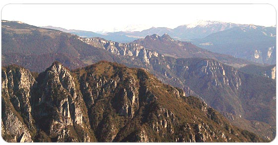
The orography of the mountainous complex between the Astico valley and Posina is very complicated.
The presence of a dividing fine line extending from east to west forms a series of strongholds arranged in this order: Mount Spitz di Tonezza, Vena Pass, Mount Melegnon, Mount Campomolon, Cima Valbona, Forcella Valbona, Mount Toraro (that represents the highest point), Sella di Campoluzzo, Mount Gusella and Mount Maggio.
Enormous buttresses and deep valleys descend to the south, the highlands of Folgaria and Serrada strech out to the north.
The enormous buttress draws its origin From Mount Maggio, western pillar of the system, developing towards south with a progressive declining slope towards the summits of Coston dei Laghi, of Mount Borcoletta and of Corno del Coston, up until the bold towers of Mount Majo in control of the upper Val Posina.
It is an important Pre-Alps area of great historical interest, specifically refereed to the first year of the war up until the Strafexpedition that started in these very places, that together with the environmental aspects, complete a truly fascinating picture.
  
|