|
Card
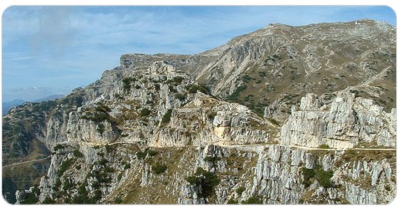
Strong and compact with a squared-shape and well defined structure, it constitutes the junction ring between the Small Dolomites and the region of the highlands, summing-up a lot of the most highlighted characteristics.
It is a great network of muleteers and trails from which the "Strada delle Gallerie" stands out for its extraordinary boldness.
The current administrative limitation between the provinces of Trento and Vicenza can also be traced on the Pasubio, the political frontier existing until 1918 between Italy and Austria - Hungary: this was the preliminary remark to the exceptional strategic role that the mountain held during the Great War.
The Pasubio's massive structure constitutes, for an operation of development such as this, the right environment to propose incentives and suggestions of the highest usability.
Mount Pasubio
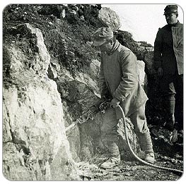
52 tunnel road, castling muleteer
Zamboni tunnel
Military road of Scarubbi with gunner caves
Military road Ponte Verde, Xomo Hill
Trenches, observatories Bocchetta Campiglia
Artillery posts
Defensive system Dente Austriaco (in Trentine territory)
Ellison tunnel (in Trentine territory)
Underground system (in Trentine territory)
Surface system (in Trentine territory)
Defensive system Dente Italiano selletta Damaggio - Cima Padon (in Trentine territory)
Battlefields Cosmagnon and Sette Croci (in Trentine territory)
Aqueduct system Malga Buse
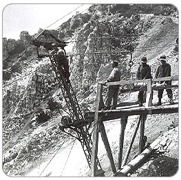
Cableway system
Fortified works Fort Maso and Tagliata Barriola
|
 - Mount Pasubio
|
 - Mount Pasubio
|
  
|