

You are here: HOME >> PLACES AND REGIONS >> CARD

Places and regions / Col di Lana - Cima Sief
The great War
Outline of the place:
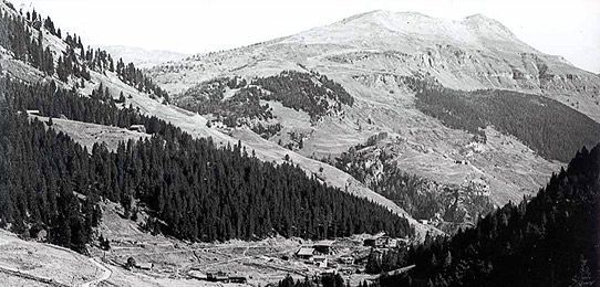
The whole area, extending from the southern slopes of the Col di Lana toward Cima Sief and from there to the towns of Corte and Contrin in the municipality of Livinallongo, was the scene of bitter fighting from early July 1915 until October 1917, which led to about 10,000 deaths, in addition to the destruction of towns and the forced exodus of the inhabitants.
The Col di Lana was actually the primary Austrian defensive bulwark blocking the Italian advance toward the Badia and Puster valleys. Today the remains of tunnels and barracks can be seen and visited Đ the places where five mines exploded in the battle for the two mountains, beginning with the first explosion on April 16, 1916 which blew off the summit and led to the Italian conquest of Col di Lana.
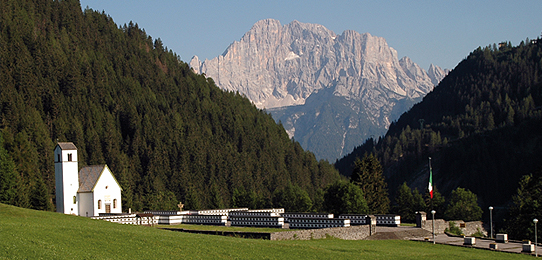
Interesting routes, well marked and not difficult, lead through the war zones in the beautiful scenery of the Dolomites, leaving from the Austrian fort at Corte or from the one at the Valparola pass (now a museum), or the villages on the slopes of the two mountains, which can be reached by a short drive from Pieve di Livinallongo.
GEOGRAPHICAL LOCATION and AREA BOUNDARY
The area is part of the municipality of Livinallongo. It extends from the villages of Palla and Agai on the southern slopes of the Col di Lana, up to the peak of Cima Lana; from there it reaches toward Monte Castello and the "Tagliata Lamarmora" to the east. From Cima Lana it extends toward Monte Sief, then north-east to the Valparola pass and south-west to the villages of Corte and Contrin.<br/>
The whole area, extending from the southern slopes of the Col di Lana toward Cima Sief and from there to the towns of Corte and Contrin in the municipality of Livinallongo, was the scene of bitter fighting from early July 1915 until October 1917, which led to about 10,000 deaths, in addition to the destruction of towns and the forced exodus of the inhabitants.
The Col di Lana was actually the primary Austrian defensive bulwark blocking the Italian advance toward the Badia and Puster valleys. Today the remains of tunnels and barracks can be seen and visited Đ the places where five mines exploded in the battle for the two mountains, beginning with the first explosion on April 16, 1916 which blew off the summit and led to the Italian conquest of Col di Lana.
Interesting routes, well marked and not difficult, lead through the war zones in the beautiful scenery of the Dolomites, leaving from the Austrian fort at Corte or from the one at the Valparola pass (now a museum), or the villages on the slopes of the two mountains, which can be reached by a short drive from Pieve di Livinallongo.
GEOGRAPHICAL LOCATION and AREA BOUNDARY
The area is part of the municipality of Livinallongo. It extends from the villages of Palla and Agai on the southern slopes of the Col di Lana, up to the peak of Cima Lana; from there it reaches toward Monte Castello and the "Tagliata Lamarmora" to the east. From Cima Lana it extends toward Monte Sief, then north-east to the Valparola pass and south-west to the villages of Corte and Contrin.<br/>
 top
top info
info print
print
Copyright 2010 - Regione del Veneto - Site Map