

You are here: HOME >> PLACES AND REGIONS >> CARD

Places and regions / Monte Padon - Marmolada - Ombretta
The great War
Outline of the place:
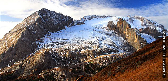
Battle front from June 1915 to October 1917, the area extends from Arabba and the Pordoi pass to the Passo Fedaia, the Marmolada glacier, and climbs from Malga Ciapela to the Ombretta pass.
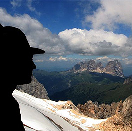
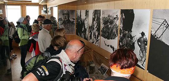
The heart of the area is, naturally, the "ice city", in the depths of the Marmolada, which is now emerging as the snows melt; but the entire area described is strewn with visible traces of the war. There are paths of varying difficulty, but they are all important for understanding what war in the mountains, and in particular on a glacier, was like.
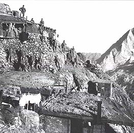
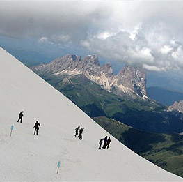
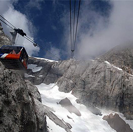
They range from high-altitude emplacements reached by the Marmolada aerial tramway, extremely attractive due to their unique environment; to paths that are easier (but very interesting from a historical and landscape standpoint) on the slopes of Padon with its north side facing the Col di Lana; to hikes of various lengths from Fedaia pass and Malga Ciapela, in the areas of the Austrian and Italian fronts respectively.
GEOGRAPHICAL LOCATION and AREA BOUNDARY
The area extends into the municipalities of Livinallongo and Rocca Pietore. It includes the immense area of the Marmolada group, from Pordoi to Malga Ciapela to Cima Ombretta. It also includes: the north face of Monte Foppa-Padon-Mesola; the south face of Padon-Mesola sloping down to the Fedaia pass, and the Marmolada glacier. Military trails leave from Malga Ciapela to the Ombretta refuge – Ombretta pass.
Battle front from June 1915 to October 1917, the area extends from Arabba and the Pordoi pass to the Passo Fedaia, the Marmolada glacier, and climbs from Malga Ciapela to the Ombretta pass.
The heart of the area is, naturally, the "ice city", in the depths of the Marmolada, which is now emerging as the snows melt; but the entire area described is strewn with visible traces of the war. There are paths of varying difficulty, but they are all important for understanding what war in the mountains, and in particular on a glacier, was like.
They range from high-altitude emplacements reached by the Marmolada aerial tramway, extremely attractive due to their unique environment; to paths that are easier (but very interesting from a historical and landscape standpoint) on the slopes of Padon with its north side facing the Col di Lana; to hikes of various lengths from Fedaia pass and Malga Ciapela, in the areas of the Austrian and Italian fronts respectively.
GEOGRAPHICAL LOCATION and AREA BOUNDARY
The area extends into the municipalities of Livinallongo and Rocca Pietore. It includes the immense area of the Marmolada group, from Pordoi to Malga Ciapela to Cima Ombretta. It also includes: the north face of Monte Foppa-Padon-Mesola; the south face of Padon-Mesola sloping down to the Fedaia pass, and the Marmolada glacier. Military trails leave from Malga Ciapela to the Ombretta refuge – Ombretta pass.
 top
top info
info print
print
Copyright 2010 - Regione del Veneto - Site Map